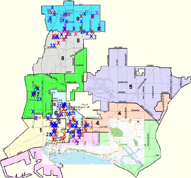
Red Xs=2014 and 2015 murders to date; Blue Xs=2014 and 2015 shootings, person wounded; Brown Xs=shots fired at victim(s), not hit; Purple Xs=2014 shots at occupied residence/vehicle; Green Xs= 2014 and 2015 shots at unoccupied vehicle/residence; Grey Xs=shots fired (no hit, no target identified); Orange X's=non-fatal stabbings. Map is unofficial.
Opinions expressed by LBREPORT.com, our contributors and/or our readers are not necessary those of our advertisers. We welcome our readers' comments/opinions 24/7 via Disqus, Facebook and moderate length letters and longer-form op-ed pieces submitted to us at mail@LBReport.com.
[Scroll down for further.]
Advertisement | Advertisement |
Scroll down for further
Advertisement | Advertisement |
Advertisement  | Advertisement |
blog comments powered by Disqus
Recommend LBREPORT.com to your Facebook friends:
Follow LBReport.com with:
RSS |
Contact us: mail@LBReport.com


Hardwood Floor Specialists
Call (562) 422-2800 or (714) 836-7050
