


See Saturday's (Nov. 30) ELB Thunderstorm Images Captured on Doppler Radar
(December 1, 2002) -- Shortly after 5:00 p.m. on Saturday, November 30, a thunderstorm passed over parts of ELB. LBReport.com captured the Doppler radar scans of the storm as they appeared live on our web site via our link to the National Weather Service.
Blue and green areas indicate light rain; yellow and brownish/orange areas transition to heavier rain...and red indicates a thunderstorm type downpour.
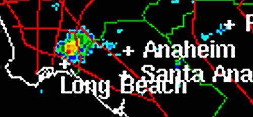 5:12 p.m., most intense part of storm is north of 405, vicinity of LB Airport.  5:19 p.m., storm lessens in intensity over the South of Conant area. 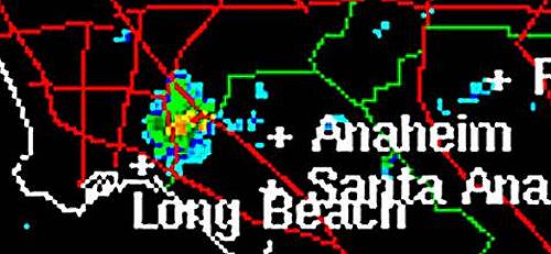 5:27 p.m., storm passes eastward out of LB. LBReport.com maintains live Doppler radar and other National Weather Service links that many readers find useful during the winter storm season. Doppler radar shows if rain is approaching, and if so, its likely intensity. Other links display the latest National Weather Service forecast for LB and the latest National Weather Service marine forecast. Additional links are provided for LB's latest hourly temperature (NWS monitor is at LB Airport) and the latest reports from other regional monitoring sites. LBReport.com's live National Weather Service links are accessible from our front page (www.lbreport.com). NWS materials are your taxpayer dollars at work, linked as a public service by LBReport.com and not copyrighted to us. |