


3853 Atlantic Ave.
|
Click here |
We Post Satellite Photos Of Tsunami Occurring...And Before & After; Councilman Colonna Agendizes Request For Tsunami Emergency Preparedness Report
(January 3, 2005) -- The catastrophic Asian tsunami -- a disaster of Biblical proportions -- was captured as it happened by a commercial satellite.
The same satellite also recorded before and after pictures of impacted coastal areas.
The images are beyond words.
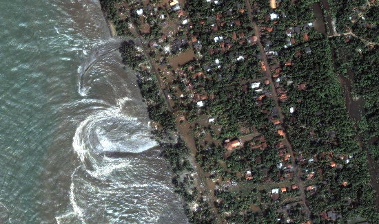
The first, over Sri Lanka, shows a tsunami wave forcefully pulling seaward after inundating the shore area.
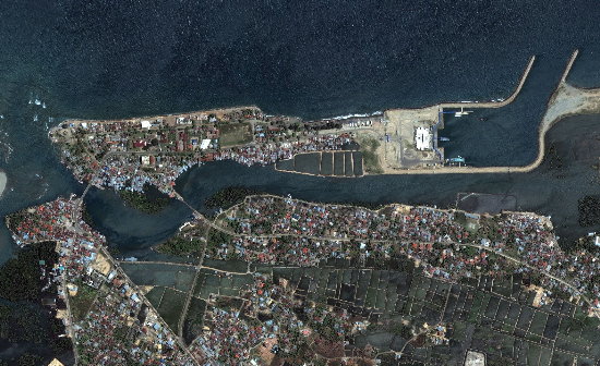
The next two photos show the Indonesian coastal area of Banda Aceh before the tsunami...
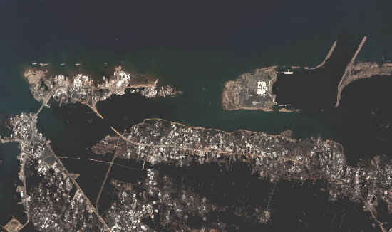
...And after.
The above images were captured by a satellite operated by DigitalGlobe, a U.S. firm that's building a constellation of high resolution earth imaging satellites.
For the January 4th City Council meeting, third district Councilman Frank Colonna -- whose district includes low-lying Belmont Shore beachfront and the Peninsula -- has agendized an item asking the City Manager to prepare a tsunami emergency preparedness report for presentation to the City Council within thirty days.
Councilman Colonna's agendizing memo requests that the report include the following:
Councilman Colonna is also requesting that LBFD and LBPD work together to produce a tsunami emergency informational video production to air on Charter Cable and be available for public
distribution.
Contact us: mail@LBReport.com |