Between 8:53 p.m. and 9:53 p.m., the NWS monitor at LB Airport recorded 0.36" of rain...and 0.30" of it came within a 15 minute period between 9:33 p.m. and 9:48 p.m. That would amount to a rain rate of over an inch per hour if it had continued...but it didn't. By 10:00 p.m., the rain rate had eased up but continued steadily.
At 9:40 p.m. smart phones sent an alert signal as NWS issued a Flash Flood Warning for "southern Los Angeles County" until 12:45 a.m. PST covering Long Beach, Torrance, Rancho Palos Verdes, Port of Los Angeles, Carson and Los Angeles Harbor."
Earlier in the day, NWS Tweeted a photo of a funnel cloud spotted off the coast of LB traveling past southern L.A. County.
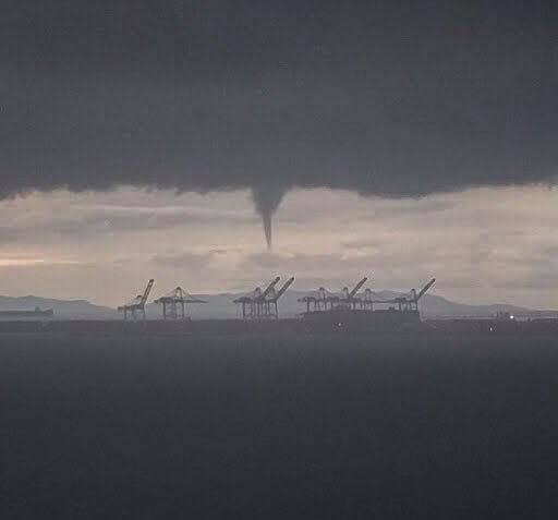
Source: NWSLosAngeles Twitter feed
They may be alarming to see but they're not all that rare; they nearly always stay off the coast and don't touch down locally...but there have been exceptions. On December 29, 2004, a fierce windstorm blew through ELB (coming from off the coast and headed inland) and NWS in Oxnard (on seeing LBREPORT.com's photos) concluded it really was a small tornado. (LBREPORT.com coverage with photos here)
And as for Sunday Jan 6, 2019, NWS predicts a 20% chance of showers before 10 a.m...then partly sunny with a high of about 61.
[Scroll down for further.]