Support the LB businesses you see here:

Carter Wood Floor pic
Carter Wood Floors, a LB company, will restore your wood floor or install a new one. Enhance your home. Click pic to learn more.

Lovelace pic
Who is this guy, Bill Lovelace? Click on picture to find out.

NetKontent
NetKontent Digital Video Cutting Edge Services For The Internet, Broadcast and Multimedia. Click For Info

Tank pic
This vehicle in Iraq (courtesy USMC) is well insured. Are you? For auto, home, business, health, boat, motorcycle coverage, call Pollman's Insurance: 23 yrs. in business, 4th generation LB family. Info, click photo


Nino's Ristorante: A delicious treasure in Bixby Knolls. Click here if you're hungry or for catering!
3853 Atlantic Ave.

The Enterlines
Bill & Karen Enterline are ELB realty experts. Click here for info on area property values.

Your E-Mail
Click here

  • Neighborhood Groups/Meetings
  • How To Recall a LB Elected Official
  • Crime Data
  • City Council Agendas
  • Port of LB Agendas
  • E-Mail Your Councilmember
  • Council District Map
  • LB Parks, Rec & Marine
  • LB Schools
  • LB Airport Watch.org
  • Sacramento
  • Washington
  • References & Archives
  • Lost, Found & Adoptable Pets
  • LBReport.com

    News in Depth

    See Satellite Photos Showing Where LB Shorter Runway 25R/7L Sends Planes; Compare It To OC Airport


    LBReport.com bases the following on public record information and input from pilots and others familiar with airport operations. Readers with relevant information can contact us at: mail@lbreport.com.

    (October 4, 2003) -- LB Airport's runway 25R/7L is roughly 62% the length of LB Airport's main 10,000 foot runway. At 6,192 feet, it is usually used mainly by small aircraft. It has occasionally been used by large aircraft when LB Airport has closed its main diagonal runway for emergency repairs or other exigent circumstances. When LB Airport closes 30/12, use of 25R/7L is technically directed by the FAA tower as an alternate.

    Runway 25R/7L is 491 feet longer than John Wayne airport's main runway. However, it differs in significant respects.

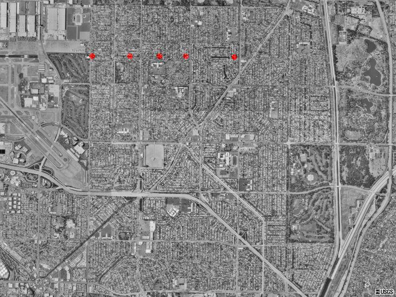
    LBReport.com posts below U.S.G.S. photos (c. 1994) permitting comparison of the approach and take off paths of LB's 25R/7L and John Wayne Airport's main runway. The color dots are by us, unofficially illustrating some expected approach and takeoff paths.

    Because 25R/7L is usually used by small aircraft, it's a visual approach "circle to land" runway and doesn't have the instrument landing system (ILS) at John Wayne's or LB Airport's main runways. However 25R/7L does have a light guidance system (a Visual Approach Slope Indicator or VASI system) which can be seen pilots, helping them establish a stable three degree glide slope into the runway. (If the aircraft is too high, the pilot sees one color, too low another).

    The eastern (approach) end of LB Airport's runway 25R/7L is just over half a mile from homes which begin at Clark Ave.

    LB Airport 25R (east)
    On some recent diversions onto 25R, we observed large jet aircraft over Los Altos east of the usual Runway 30 approach, then banking left over what appeared roughly (very roughly estimated) somewhere between El Dorado Park and (in one case) what appeared to be roughly Spring/Palo Verde before heading into 25R. The approach is nearly entirely over homes stretching for miles.

    LB Airport 25R (west)
    25R's western end is only roughly a quarter of a mile from homes which begin just west of Cherry Ave.

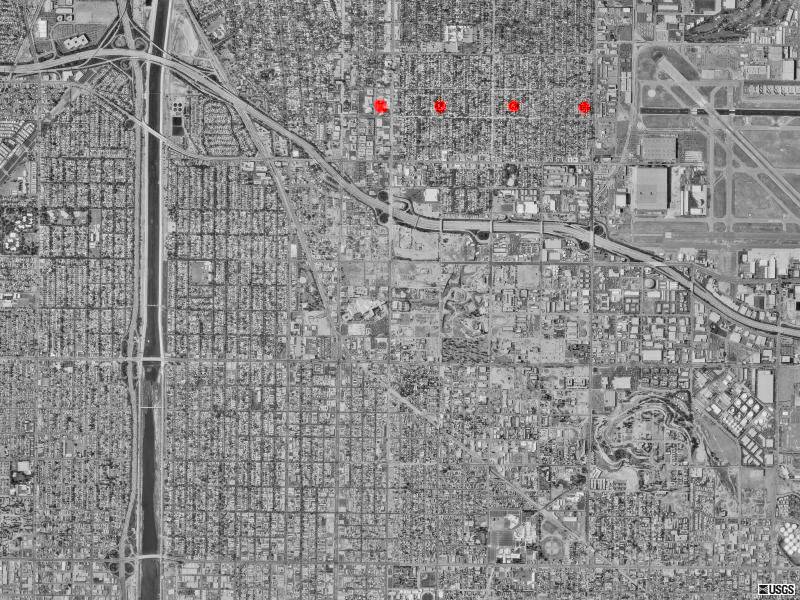
    In contrast to LB, John Wayne Airport's approach does not go over homes:

    SNA (north)
    Planes come over industrial parks and commercial industrial facilities. The nearest homes are miles away to the north and off to the side.

    SNA (south
    There are small pockets of apartments and homes to either side of John Wayne's takeoff path, but planes mainly ascend over a golf course and Newport's Back Bay. Some homes are on hillsides on the sides of the Back Bay. Densely populated areas begin further south and west, by which time aircraft are higher.

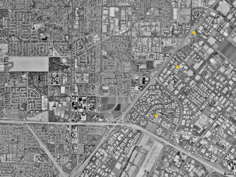
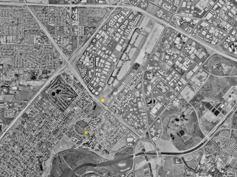
    The view below is twice as far away, showing that John Wayne's approach over
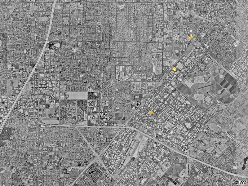
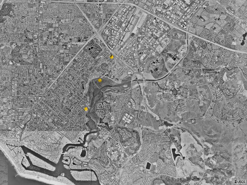
 non-residential industrial areas stretches for miles.

    SNA (north)
    The approach is basically over freeway and light industrial areas.

    SNA (south
    This view on the takeoff end is likewise twice as far away, showing residential areas south and west of John Wayne runway's end.


    Return To Front Page

    Contact us: mail@LBReport.com


    Copyright © 2003 LBReport.com, LLC. All rights reserved. Third parties may cite portions as fair use if attributed to "LBReport.com" (print media) or "Long Beach Report dot com" (electronic media). Terms of Use/Legal policy, click here. Privacy Policy, click here.